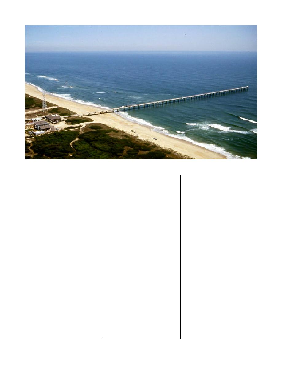
Figure 1. Aerial view of the Field Research Facility showing pier, buildings, and observation tower
! Provide a field facility for evaluat-
! Control of the surrounding area to
program. Storms could not be well
documented because the piers on
ing new instrumentation.
avoid interruptions in research
which the gauges were mounted
programs.
The primary facility would be a
were either destroyed or were too
! An adjacent sound or estuary
concrete and steel pier constructed
shallow to measure unbroken
sufficiently high to be above
area.
waves. Establishment of the FRF
expected storm waves and surge,
! Availability of commercial power
would complement CERC's physical
and long enough to cross the most
and communication facilities.
modeling facilities and serve the fol-
active zone of sediment transport.
! Usually free of fog or cloud cover
lowing functions (Mason 1979):
The search for a suitable site con-
to allow frequent use of aerial
! Provide a rigid platform from land,
sidered a large number of criteria
remote sensing.
across the dunes, beach, and
including:
! A stable coastline (on a time
surf zone out to the 6-m (20-ft)
! Sand size typical of U.S. coasts
water depth from which waves,
scale of 50 years)
and sufficient depth of sand to
currents, water levels, and bottom
! Natural dunes.
prevent underlayer exposure.
elevations could be measured,
! Wave climate and storm exposure
The FRF became a reality
especially during severe storms.
representative of U.S. coasts.
through the efforts of Colonel
! Serve as a permanent base of
Donald S. McCoy, then commander
! Regular offshore bottom topogra-
operations for physical and bio-
of CERC (Moore and Moore 1991).
phy free of features that may alter
logical studies of the site, the
Sites all along the eastern coast of
the wave climate.
adjacent sound and ocean region
the United States were considered
! Tidal range of 0.5 to 2.0 m (1.5 to
by the Corps, other Federal agen-
and originally a site within the
cies, universities, and private
6 ft).
Assateague National Seashore in
industry.
! Representative nearshore slope
Maryland was selected. However,
! Provide the Corps with field expe-
with the 6-m- (18-ft-) depth con-
the site was changed to Duck, NC,
rience and data that would com-
tour within 600 m (2,000 ft) of
when the National Park Service
plement laboratory and analytical
shore.
retracted their endorsement of the
studies and provide a better
project.
! A straight coastline outside the
understanding of the influence of
range of the effects of any signifi-
Though more remote, the Duck
field conditions on measurements
cant littoral barrier.
site satisfied all criteria, except pos-
and design practices.
sibly the sediment one. Duck beach
sands are typically bimodal
12


 Previous Page
