ERDC/CHL CHETN-VII-5
December 2003
GIS analysis:
The information in this section was taken from Hendrickson and Hrdlicka (2003). St. Paul District
personnel, using a multitransducer survey boat whose position is tracked using a digital global
positioning system, obtained hydrographic surveys of the main channel. Surveys were obtained from
L&D 8 at RM 679.2 to L&D 7 at RM 702. Personnel at the St. Paul District Geographic Information
Center used ArcView software to create bathymetry models of the main channel between RM 686
and 691 to determine the difference in bathymetry from one year to the next. This was done for the
period 1998 to 2003, except that data were not available for the year 2000.
The measurement of hydrodynamic and sediment parameters and the direct measurement of sand
wave movement using the ISSDOT method both support the hypothesis of increased sediment
transport during the drawdown. However, the GIS computations do not seem to indicate large-scale
or long-term changes in main channel bathymetry during the drawdown.
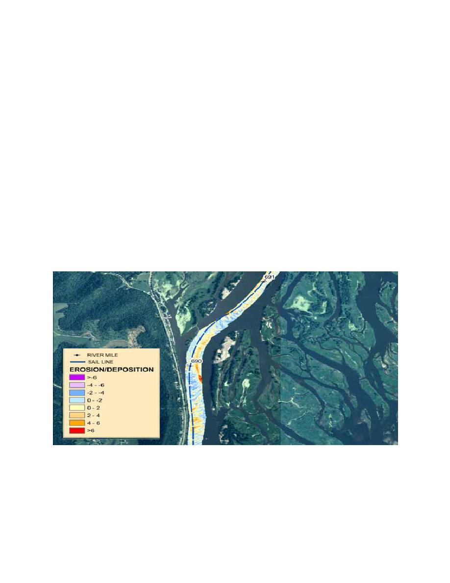
Figure 6 shows that most changes between 2001 and 2002 fell within the range of 0.6 m (2 ft) of
deposition to 0.6 m (2 ft) of erosion and probably represent typical bathymetric changes. There were
a few areas where as much as 1.8 m (6 ft) of erosion or deposition occurred, but these were small in
area and didn't represent a large-scale trend. It is possible that channel degradation occurred during
the actual drawdown, but the channel had filled back in before the surveys that were used in the GIS
analysis were taken; however channel maintenance personnel working in this area did not notice this.
Figure 6. Map showing scour and deposition in study area
Figures 7 and 8 show the net main channel volume change and annual dredging between RM 686
and 691 for the years 1999 to 2003. The annual volumetric change for each river mile was obtained
by generating difference plots based on surveys for each year. The survey dates were inconsistent
from year to year. The 1999 surveys were done throughout the year, 2001 surveys were done in early
9


 Previous Page
