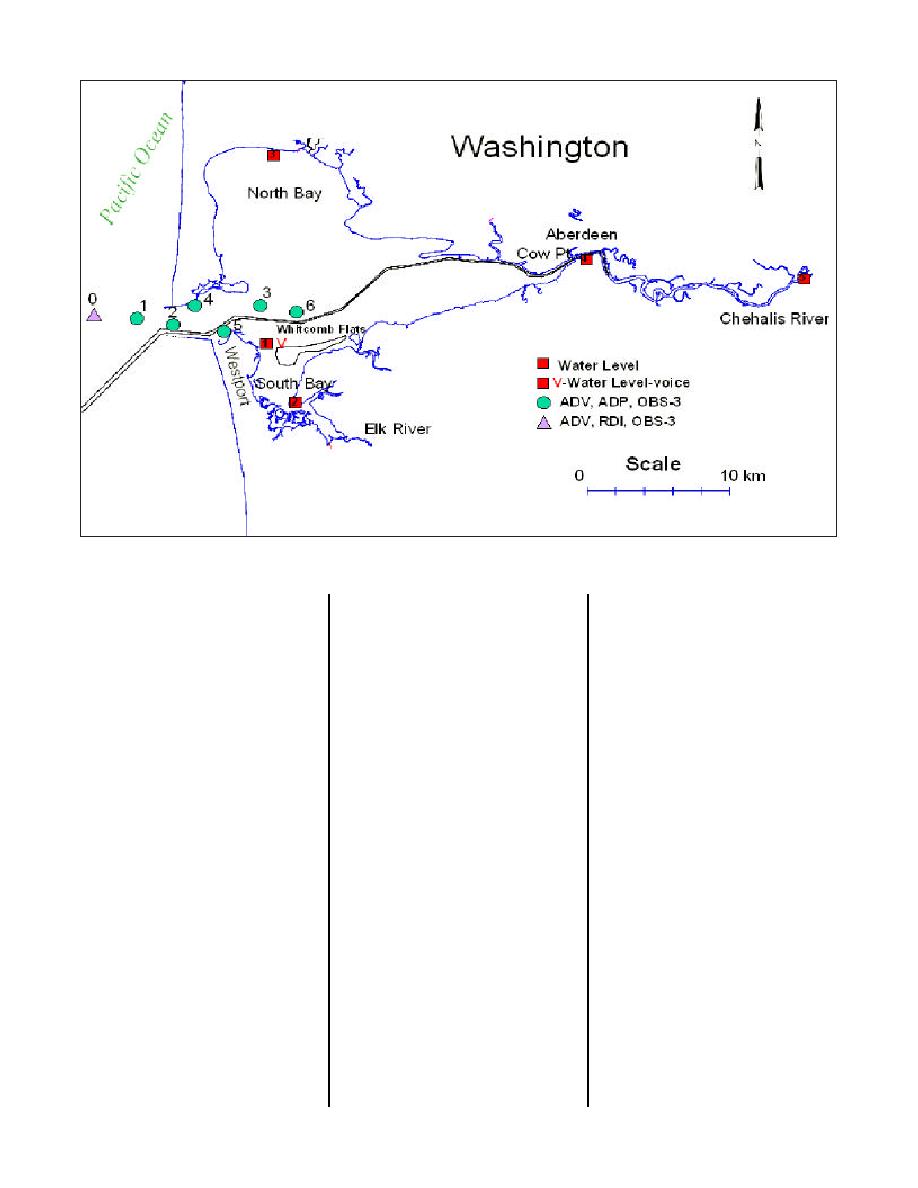
Figure 1. Grays Harbor, WA, location map and field-data collection schematic
(depth-averaged) version of ADCIRC
improved wave modeling in the
Figure 4 is a time-series of water
was applied. The Corps' Coastal
presence of a strong current,
surface elevation from the field data
Inlets Research Program (CIRP) has
STWAVE will give reliable estimates
collection time period and computa-
enhanced ADCIRC to include flood-
of sea-state in the channel. It can
tions at South Bay and Aberdeen
ing and drying, and it has exercised
also quantify storm wave conditions
(see Figure 1 for locations). Model
the model in shallow water estuarine
as a function of the wind. The CIRP
results correspond to the field data
conditions such as at Willapa Bay,
is presently upgrading STWAVE to
both in amplitude and phase at both
WA and as a reconnaissance-level
include diffraction through a gap, as
the southern and eastern ends of
study at Grays Harbor, WA. The
found at the Grays Harbor jetties
the bay. Figure 5 is a time-series of
reconnaissance-level application of
that open to the bay.
current speed from the field data
the ADCIRC model at Grays Harbor
collection time period and computa-
was enhanced and refined with field
tions at Inlet stations 2 and 4. Com-
Tidal Circulation Modeling
data collected in the Corps' naviga-
putations correspond to the field
tion study.
data in amplitude with slight phase
A finite-element grid was devel-
differences, attributable to
oped for the ADCIRC model to sim-
The steady-state spectral wave
bathymetric inaccuracies. Ebb and
ulate water-surface elevation and cir-
model STWAVE has been modified
flood current data and model results
culation as a function of tidal and
in the CIRP to represent the
show the strongest flood currents
wind forcing over the entire Grays
wave-current interaction including
are on the north side of the inlet.
Harbor region (Figure 3). The
the wave-action equation, cur-
Ebb currents are more uniformly dis-
ADCIRC grid contains 31,838 ele-
rent-induced breaking, and wave
tributed (Figure 6).
ments and 16,916 nodes, with the
blocking by a current (Smith, Resio,
finest resolution along the Federal
and Zundel 1999). Communication
Wave Propagation Modeling
navigation channel. The shoreline
between ADCIRC and STWAVE is
north of Grays Harbor (known as
necessary in this study for comput-
Ocean Shores) also shows fine grid
A computational grid for the
ing wave-generated currents through
resolution and is part of another
region shown in Figure 7 was devel-
the transfer of the radiation stresses
coastal study. The ADCIRC model
oped for the Steady-State Spectral
from STWAVE to ADCIRC and the
was driven with the Le Provost et al
Wave Model (STWAVE), which com-
transfer of tide-, wind-, and
(1994) tidal constituent database for
putes nearshore wind-wave growth
wave-generated currents from
the field-data collection time period
and propagation (Resio 1987,
ADCIRC to STWAVE. In addition to
(September to November 1999).
1988a, 1988b; Davis 1992). (This
28


 Previous Page
