

712
Stauble and Tabar
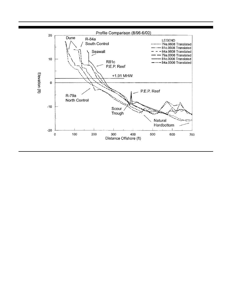
Figure 26. Representative profile monitoring of the P.E.P. Reef at Vero Beach site. (a) Profile R-79A in the north control, R-81C in the P.E.P. Reef, and
R-84A in the south control zones (Stauble, 2002).
to be formed by wave/structure interaction-induced currents.
of monitoring, the tops of the P.E.P. Reef units were surveyed
during the profile without scraping off the biofouling so exact
The width varied between 3 and 9 m (10 and 30 ft), with a
measurements of the settlement could not be ascertained.
depth of 1.22 to 1.83 m (4 to 6 ft). Comparisons were made
Based on comparisons of the August 1997 and June 2000 sur-
between scour at the north, central and southern units, sea-
veys, all of the units have still shown a settlement from ini-
ward and landward of each unit, at inshore and offshore
tial installation.
units, and at the P.E.P. Reef units versus natural profiles in
the north and south control zones in the first two years. Mea-
Scour
surements indicate the persistence of the landward scour
trench over the entire study period. A seaward trench was
A scour trench persisted over the entire study period from
present mostly after storm events, but would fill in during
August 1996 to June 2000 on both the landward and seaward
fair weather periods.
side of the reef. The landward scour trench averaged 1.22 m
(4 ft) deep and 6.4 m (20.9 ft) wide and was present along
Wave Attenuation
the landward side of the entire length of the P.E.P. Reef. The
scour trench seaward of the P.E.P. Reef was not as persistent,
Measurements from five puv wave gage stations made from
and occurred mostly after storms. One was formed after the
1996 to 1998 indicate that incident wave heights landward
tropical storms, measured in the December 1999 survey, but
of the P.E.P. Reef were reduced by an average of 12% after
had filled in by the June 2000 survey. A general pattern has
initial installation. However, following the initial four-month
emerged with the seaward scour trough present after storms
settlement of the structure, wave height reduction averaged
and filled in after more of a fair weather period.
between 8 to 9%. A shorter monitoring data set from the con-
Formal monitoring of the scour trench was only scheduled
trol location south of the P.E.P. Reef indicated that, over the
to extend for the first two years of monitoring. As reported
natural hardbottom the wave height difference ranged from
in the Second Annual Monitoring Report (STAUBLE and
an increase of 3% to an attenuation of up to 9%, based on the
SMITH, 1999), scour rods were placed at the north, center and
difference between the seaward control wave gage and the
south units of the P.E.P. Reef. The detailed measurements of
landward control wave gage. These data suggest that the
the sand elevation at these rods at various times within the
P.E.P. Reef has minimal effect in attenuating wave energy,
first two years indicated that a permanent scour trench was
particularly after settlement of the reef structures.
located landward of the breakwater. This trench is believed
Journal of Coastal Research, Vol. 19, No. 3, 2003

 Previous Page
