Submerged Narrow-Crested Breakwaters
689
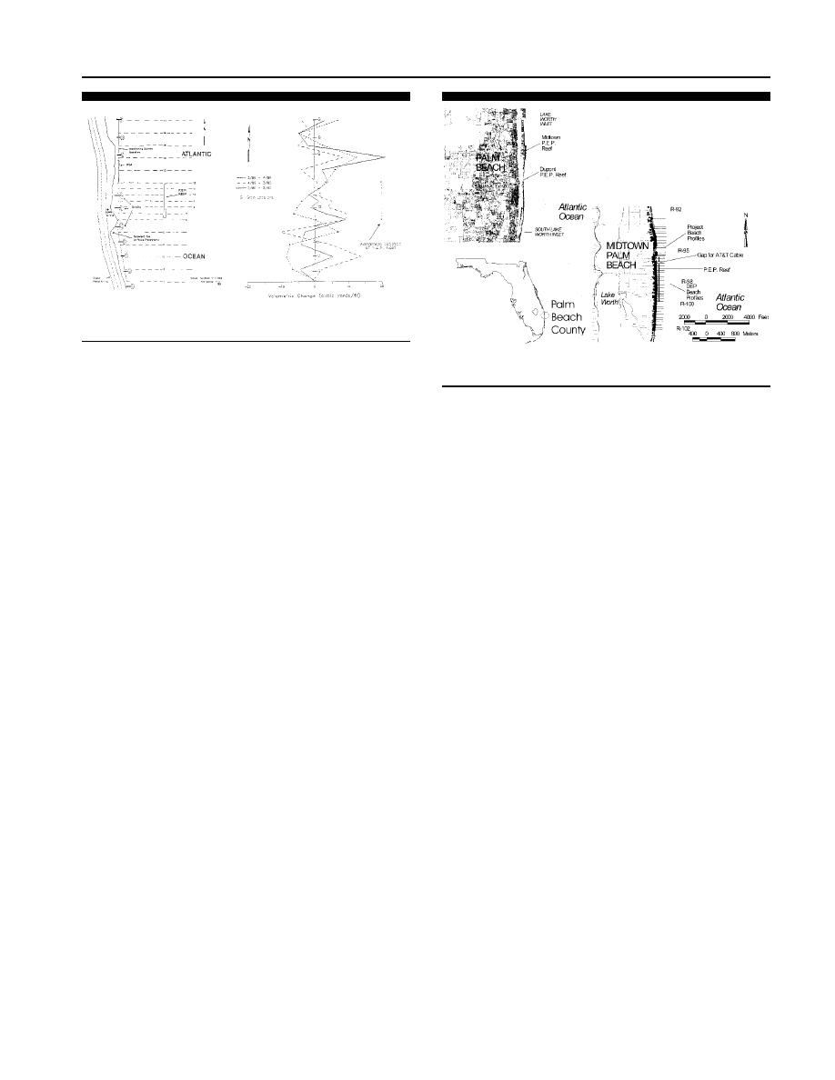
Figure 5. Comparison of the annual volumetric changes at Dupont prop-
erty, Palm Beach County, Florida (after Leadon, 1991).
Figure 6. Location of the P.E.P. Reef installations at Midtown Palm
Beach, Florida.
concluded that there was no net benefit in shoreline position
stability between the pre-installation and two-year surveys
leeward of the reef.
Project Performance
Sediment Volume Response
At the end of the two year monitoring, the mean high water
shoreline had moved landward of the pre-project position.
Volume change analysis compared the change in profile
Seasonal changes in profile response were also measured.
volume between each survey period. The volume change pat-
The existing structures (seawalls and groins) had an effect
tern was reported as very irregular due to the existing shore
on both the shoreline and volume change patterns that were
protection structures in the study area (LEADON, 1991). Fig-
difficult to separate from the P.E.P. Reef presence. Volume
ure 5 shows a comparison of the annual volumetric changes
change indicated a variable pattern, with some gain and
for the first year (March 1988 to April 1989), the second year
some loss in sand volume, but the changes could not be di-
(April 1989 to March 1990) and a total pre-installation to
rectly attributed to the P.E.P. Reef (LEADON, 1991). The
final monitoring period (March 1988 to March 1990). A gain
units were dislodged and scattered by the strong northeaster,
in volume was found during the first year of monitoring in
and required realignment. WOODRUFF (1994) reported that
the north control area, a loss in the lee of the north half of
the project had little beneficial effect on the beach and was
the P.E.P. Reef area and a gain in the southern half of the
ordered removed. The units were eventually left in place as
P.E.P. Reef based on the profile survey after the storm in
an artificial reef and are providing habitat for marine organ-
March 1989. A loss was also measured just south of the reef,
isms.
with a gain further to the south in the control area. The sec-
ond year showed a similar pattern but the north control area
MIDTOWN PALM BEACH, FL PROJECT
volume gain was less than the first year and the gain and
loss in the south area was more pronounced. The overall
A second project, the Midtown Palm Beach project, was
change in volume showed a variable pattern with gain in the
constructed to mitigate for coastal erosion on the Atlantic
north control, loss behind the P.E.P. Reef increasing to the
Ocean shoreline of the Town of Palm Beach, FL. The units
south, and a gain just to the south of the reef but loss further
were placed in 2.87 m ( 9.4 ft) NGVD of water around 76.2
to the south. The net drift is to the south in this area.
m (250 ft) from the shoreline on the Atlantic Ocean in the
Analysis of contours and surface maps also showed a sim-
Town of Palm Beach Florida some 7.2 km (4.5 miles) south
ilar pattern. It was noted that any surface change that oc-
of Lake Worth Inlet (Figure 6). Net drift in that region is to
curred, was found on both the landward and seaward sides
the south with the prevailing wave approach direction from
of the reef and appeared to not be the result of the reef LEA-
the northeast to east (STAUBLE, 1993). Previous erosion has
DON (1991). No recognizable benefits could be identified from
resulted in armoring of most of the shorefront with seawalls
this monitoring data.
and revetments. A natural hardbottom composed of coquina
(a semi-cemented shell and quartz sand) beach rock outcrops
Structural Stability
around 304.8 m (1,000 ft) offshore and has a crest elevation
of 2.44 m ( 8 ft) NGVD. The project was installed in two
The northeast storm in 1989 caused some of the units to
move seaward (MITCHELL, 1994). The reef units were re-
phases, with the first 52 P.E.P. Reef units placed in July
aligned after the storm and the monitoring was continued
August 1992. Hurricane Andrew impacted the area as the
LEADON (1991). No further movement was measured during
reef was under construction. Post-hurricane surveys indicat-
the second year of monitoring.
ed that the reef units had settled further than settlement
Journal of Coastal Research, Vol. 19, No. 3, 2003


 Previous Page
