688
Stauble and Tabar
Table 1. Monitoring for P.E.P. Reef at Dupont property, Palm Beach, FL.
Year
Month
Profile Survey
Events
1988
March
Pre-Survey
May
P.E.P. Installation
Post-Survey
August
Survey
December
Survey
1989
February
Survey
March
Northeaster
April
Survey
July
Survey
November
Survey
1990
March
Survey
the profile, which originated at the project-established base-
line.
Monitoring Results
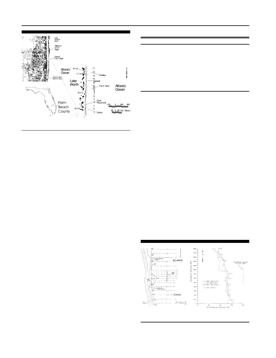
Figure 3. Location of the P.E.P. Reef installations at the Dupont prop-
Shoreline Response
erty, Palm Beach County, Florida.
The shoreline, defined as the mean high water line
(MHWL), was determined from beach profiles. The pre-pro-
PALM BEACH, FL--DUPONT PROPERTY PROJECT
ject shoreline was irregular and no consistent pattern was
found in the response of the shoreline over the project-mon-
The first installation of the P.E.P. Reef was in May 1988.
itoring period (LEADON, 1991). A general seasonal signal was
A 23-unit breakwater was placed in a continuous 168 m (552
found with gain in sand and seaward movement of the shore-
ft) long line, located 53 m (175 ft) offshore of the mean high
water line in about 2.4 m ( 8 ft) NGVD of water at the
line during calm wave periods (usually in the summer) par-
ticularly near the groins. Figure 4 shows the irregular change
Dupont property on the Atlantic Ocean in Palm Beach Coun-
in MHW shoreline position from the pre-installation (March
ty, Florida (MITCHELL, 1994). This property had suffered
1988), the post storm (April 1989) and the final two-year
shoreline erosion in the Thanksgiving Storm of 1984. Flori-
monitoring (March 1990). The general trend was for shoreline
da's Department of Environmental Protection (DEP) has es-
retreat from the pre-installation survey to the post-storm sur-
tablished a beach profile network statewide with R-monu-
vey, with a larger retreat in the northern control area just to
ments approximately every 304.8 m (1,000 ft) along most of
the north of the reef location. In the lee of the reef structure,
the state's Atlantic and Gulf of Mexico shoreline. The project
the shoreline position was the same as after the storm except
was located near DEP monument R-115 in Palm Beach Coun-
for one survey line between two groins that was just seaward
ty (Figure 3) and covered an area 128 m (420 ft) north and
of the pre-installation position. The area south of the reef,
54.9 m (180 ft) south of the monument. This initial installa-
showed a seaward movement after the storm at one groin
tion of the P.E.P. Reef was of the larger units. Several exist-
location but for the most part, the shoreline in March 1990
ing shore protection structures were already present, includ-
was landward of the March 1988 location. LEADON (1991)
ing a series of short T-head groins; a low, vertical concrete
seawall; and a rock revetment, which created an irregular
shoreline prior to P.E.P. Reef installation (LEADON, 1991).
The P.E.P. Reef installation was seaward of all of these ex-
isting shore protection structures. Natural hardbottom is lo-
cated seaward of the breakwater, but the reef was placed on
a sand bottom and the effects of the hardbottom were not
discussed.
Monitoring Program
This project had a limited monitoring program, consisting
of profile surveys covering a two-year period from pre-instal-
lation in March 1988 through March 1990 (LEADON, 1991).
A series of 17 project specific beach and nearshore profile
locations were established approximately 61.0 m (200 ft)
apart for 305 m (1,000 ft) north and south of the reef units
and 30.5 m (100 ft) apart in the vicinity of the reef (Figure
Figure 4. Comparison of the annual shoreline changes at Dupont prop-
3). Surveys were conducted on a 3-month interval (Table 1).
erty, Palm Beach County, Florida (after Leadon, 1991).
The profiles did not survey the landward 30.5 m (100 ft) of
Journal of Coastal Research, Vol. 19, No. 3, 2003


 Previous Page
