192
P. Wang et al. / Coastal Engineering 46 (2002) 175211
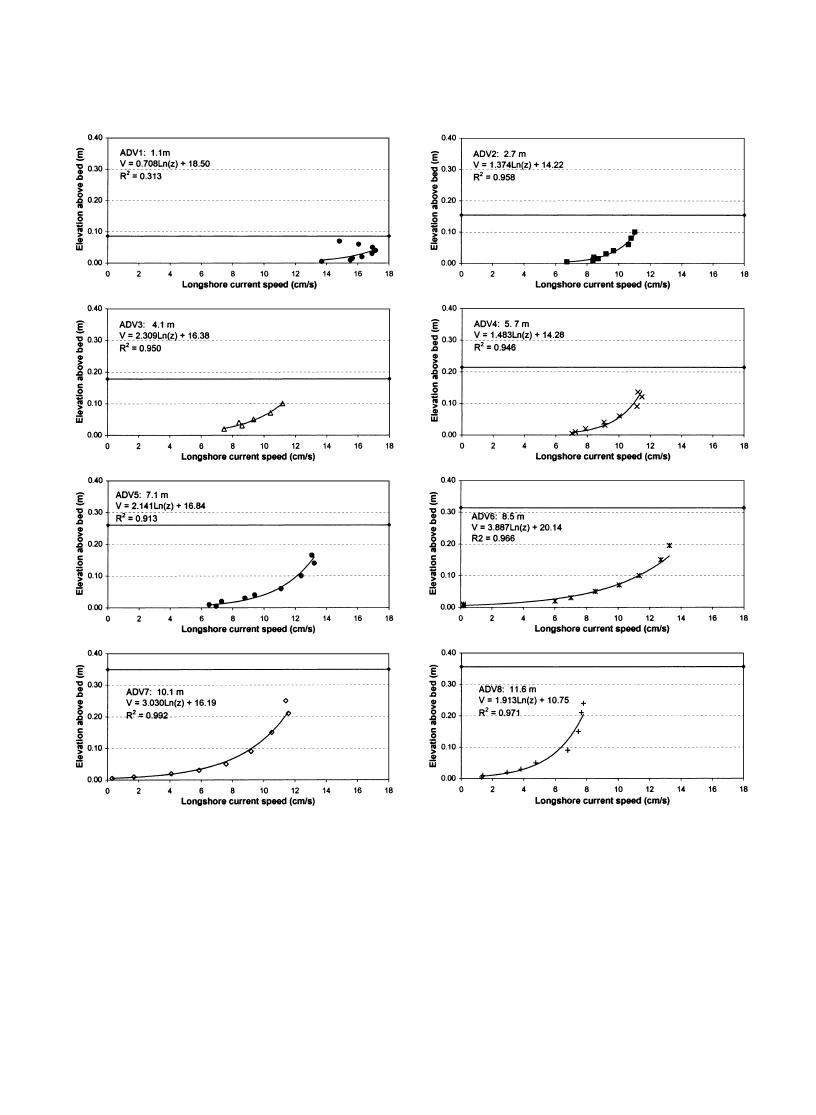
Fig. 12. Profiles of time-averaged longshore current at various locations across the surf zone, spilling case. Solid horizontal line indicates still-
water level.
shore direction, the depth-averaged longshore current
zone from approximately 11 to 15 m. A small
was nearly constant from 4 to 11 m from the shore-
reversal in the longshore current was measured at
line (Fig. 14). The greatest longshore current speeds
the seawardmost ADV, indicating the presence of
were measured at the landwardmost ADV1 at 1.1 m
recirculation. Minimizing recirculation in the LSTF
and, in both cases, the current speeds decreased in
is discussed in detail in Hamilton and Ebersole
the seaward direction through the incipient breaker
(2001).


 Previous Page
