

ERDC/CHL CHETN-III-69
March 2004
ADDITIONAL PROTOTYPE WAVE DATA: The MCNP-supported prototype data collection
effort was planned for the fall of 2002. It included an offshore directional wave gauge lakeward of
the Pentwater jetties and nondirectional wave gauges along the north side of the channel lakeward
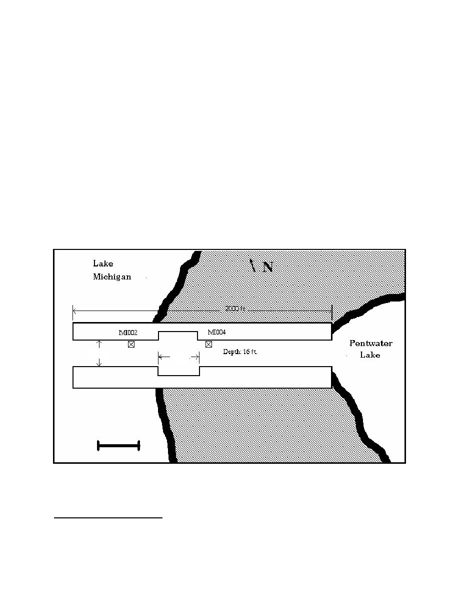
and landward of the pocket absorbers (Figure 8). Gauge deployment was delayed until early April
2003. The channel gauges, designated MI002 and MI004, collected hourly data during the 7-week
deployment. The offshore gauge failed to provide any incident wave data. Time series data from the
channel gauges were subjected to spectral analysis and interpretation by McKinney and Sabol
(2003). Long-period motions, with possible periods as long or longer than the 1,024-sec time series,
were evident in some records. The long periods may be related to natural oscillations in Lake
Michigan and inlet/harbor resonance at Pentwater, as described by Seelig and Sorensen (1977), but
record lengths are too short to evaluate this possibility. For the long-period motion events high-
MI, 16 km (10 miles) north of Pentwater, shows prominent oscillations with approximate height and
period of 30 cm (11.8 in.) and 1 hr, respectively. A recent study using water level data and numerical
modeling to identify natural oscillation modes in Lake Michigan, shows several modes with periods
near 1 hr and antinodes located in the coastal scallop between Big Sable Point and Little Sable Point,
which includes both Ludington and Pentwater (As-Salek and Schwab 2004). Strengths and
limitations of this field data collection effort are summarized in Table 3.
140 ft
5
195 ft
SCALE (FT)
0
200
Figure 8. Location of MCNP wave gauges, Pentwater, MI
1
McKinney, James P., and Sabol, Margaret A. (2003). "Evaluation of the Wave Absorber at Pentwater, Michigan,"
Unpublished report, U.S. Army Engineer Research and Development Center, Vicksburg, MS.
9

 Previous Page
