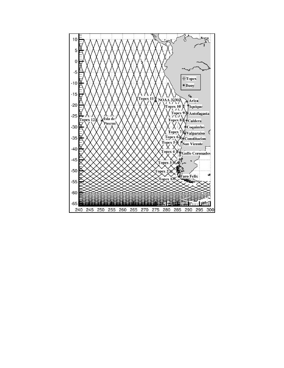
Figure 4. Locations of Regional Wave Measurements
[Lines Show Topex Ascending/Descending Tracks]
3.2 Satellite Altimeter Measurements
Satellite altimeter wave data from the Topex/Poseidon mission were used extensively in the wave climate study.
Several quality control procedures were applied to the altimeter data in order to eliminate spurious measurements
prior to statistical analysis of the data. The data were also corrected for Side A drift from April 1, 1997 to January
31, 1999, and for the new calibration that resulted when the Side B sensor became active (Cotton, 2001). The
satellite data were derived from the average wave height measurement in each satellite pass through a 0.5-degree
box centered at satellite crossover locations. Data from a total of 12 different locations were considered, as shown
in Figure 4.
4.
APPLICATION OF THE WAVE MODEL
4.1 Model Description
The WAVAD wave model, as summarized in Resio (1981) and Resio and Perrie (1989), was used for all of the
hindcasting carried out in this study. WAVAD is a second generation (2G) spectral wave model that maintains an
equilibrium between the wind source and non-linear wave energy flux with an assumed f-4 shape for the wave
spectrum. The non-linear wave interactions are represented as a momentum flux to the forward face (frequencies


 Previous Page
