

6.
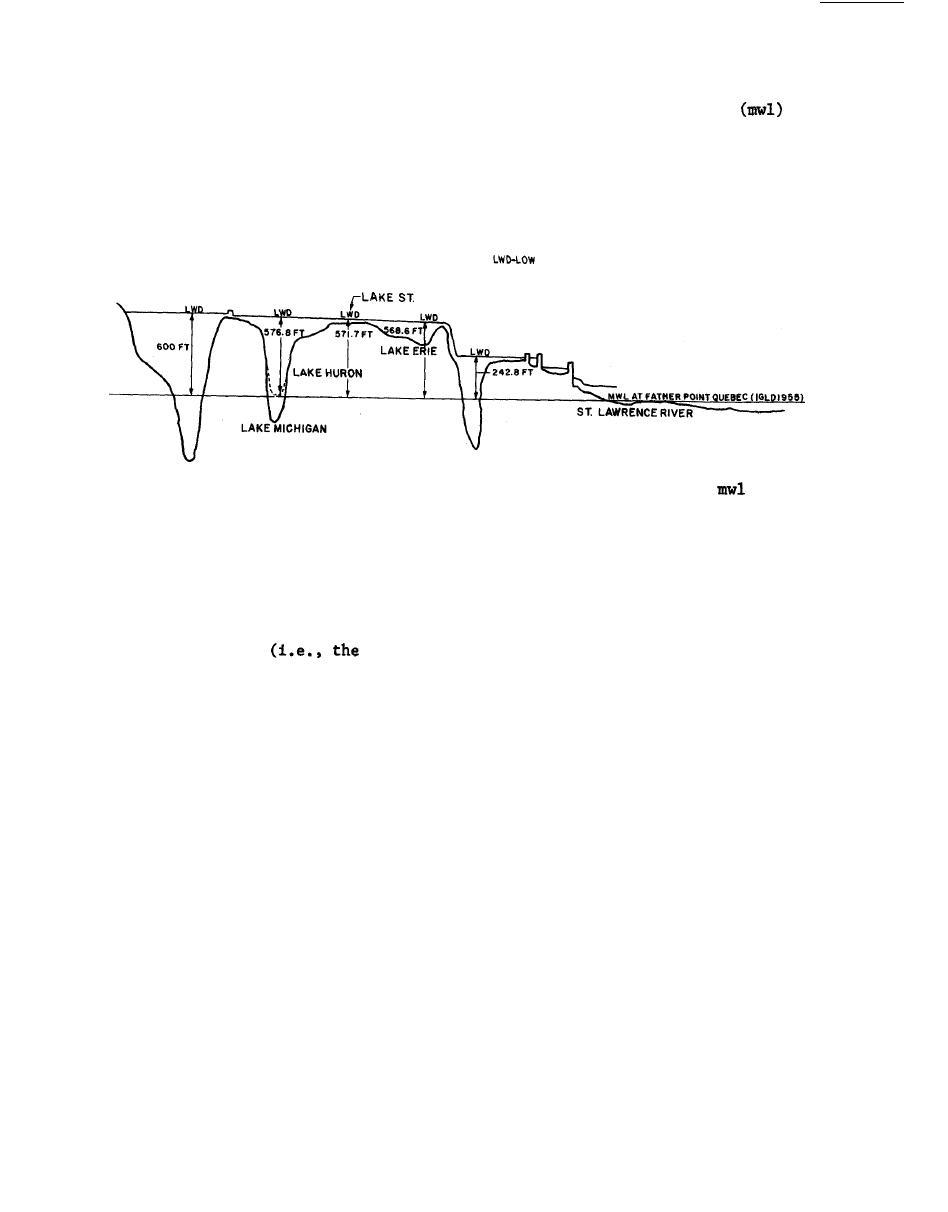
The els of various structures and depths on the Great Lakes are
based on low water datum (lwd) which is referenced to mean water level
at Father Point, Quebec, according to the International Great Lakes Datum
(IGLD) of 1955.
tal and vertical distances have been distorted somewhat to convey visual
impression.
IGLD-INTERNATIONAL GREAT LAKES DATUM
WATER DATUM
MWL-MEAN WATER LEVEL
CLAIR
LAKE ONTARIO
LAKE SUPERIOR
Figure 4 .
Profile of the Great Lakes region (lwd referenced to
at Father Point, Quebec according to IGLD of 1955)
Case histories for NCD's breakwater and jetty structures are pre-
7.
sented in Tables 1-107.
Figures depicting structure alignments, cross
sections, and aerial photographs for some sites accompany the various tables.
Sites are presented in the order of west to east and counterclockwise along
the lake shoreline
first site being presented on the northwest end
of Lake Superior and the last on the east coast of Lake Ontario).
General
characteristics of the structures at the various sites are shown in the f o l -
lowing tabulation:
10

 Previous Page
