

COMPARISON OF GULF OF MEXICO WAVE INFORMATION STUDIES (WIS) 2-G HINDCAST
WITH 3-G HINDCASTING
Barbara A. Tracy and Alan Cialone
Engineer Research and Development Center
Coastal and Hydraulics Laboratory
Waterways Experiment Station
Vicksburg, Mississippi, USA
2.0 HINDCAST GRID
1.0 INTRODUCTION
The Gulf of Mexico hindcast application consists of
The Wave Information Studies (WIS) at the Coastal
three grid levels. Level 1 (1 deg latitude/longitude
and Hydraulics Laboratory (CHL), Engineer Research
grid spacing) includes the Atlantic Ocean and the
and Development Center (ERDC), Vicksburg, MS,
entrance to the Gulf of Mexico. Level 1 extends from
recently completed twenty years (1980-1999) of wave
83.0 to 20.0 deg longitude and 0.0 to 72.0deg
hindcasts for the Gulf of Mexico using the second-
latitude. Energy from the Level 1 grid enters the
generation wave model, WISWAVE. Hourly wave
Level 2 grid at boundary locations on the eastern edge
parameter results for coastal stations in 10-20 m of
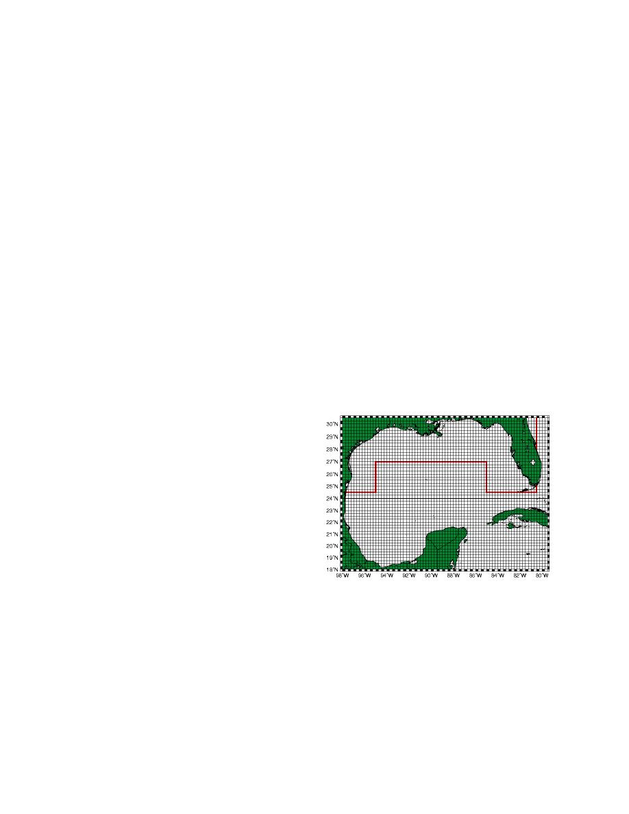
of the Gulf of Mexico. Figure 1 shows the Gulf Level
water from this hindcast are available on the WIS
2 and Level 3 hindcast domains. The Level 2 grid
website: frf.usace.army.mil.wis. This wave
extends from 98.0 to 80.0 deg longitude and from
information has been used by the Army Corps of
18.0 to 30.5 deg latitude. Level 2 grid spacing is 0.25
Engineers and private consulting companies for a
deg latitude/longitude. The red line that extends from
variety of coastal engineering applications and
the Mexican coast to the tip of Florida in Figure 1
represents an invaluable resource for the coastal
shows the boundary locations where energy enters the
engineering community. WIS is commited to
producing high-quality wave information; and thus, it
is important to compare the results of this hindcast
with hindcast results using the newer third-generation
wave modeling technology. These comparisons are
valuable for the coastal engineers that use this
information and also help WIS evaluate new
hindcasting regimes for future wave studies.
This paper shows results of three hindcasts using the
same input wind fields and the same nested grid
system. Results will be shown at available
measurement sites for the 1995 Level 2 (0.25 deg) and
Level 3 (1/12 deg spacing) Gulf of Mexico hindcast.
The second-generation model results were taken from
WIS information calculated using the Corps of
Engineers numerical wave model, WISWAVE. Two
Figure 1. Level 2 and level 3 Gulf of Mexico
third-generation models, WAM (Komen et al., 1994,
hindcast grids. Level 3 boundary points are shown
WAMDIG, 1988) and WAVEWATCH III (Tolman,
by the red line.
1991 and 2002), were used to produce comparison
Level 3 nest from the Level 2 nest. Level 3 resolution
results for the 1995 Gulf of Mexico hindcast.
is 1/12 deg. The hindcast encompassed the twelve
Statistical comparisons of significant wave height,
months of 1995. A cold start was used for the January
mean wave period, and peak wave period for the
run and restart files were saved at the end of each run
hindcast results will be shown for measurement sites
for hindcast continuity.
available in the Gulf of Mexico during 1995. NDBC
42036 and 42001 have directional information during
Hindcast results were saved at the available
1995, and circular wave directional comparison
measurement sites within the Level 2 and Level 3
statistics are shown for these locations using the
grids. Table 1 lists the available Level 3 measurement
circular direction techniques outlined in Tracy (2002).

 Previous Page
