Fundamentals of Engineering Design
Table 5.5
Bed Material Load (Sand Fraction) Relationships at Gaging Sites in the Yazoo Basin,
Mississippi
R2
Station No.
Station Name
a
b
N
7285400
Batupan Bogue at Grenada, MS
0.000000468
1.549
0.77
340
7287150
Abiaca Creek near Seven Pines, MS
0.00000362
1.506
0.62
138
7287160
Abiaca Creek near Cruger, MS
0.00000000395
2.37
0.73
108
7287355
Fannegusha Creek near Howard, MS
0.000000576
1.745
0.97
13
7273100
Hotopha Creek near Batesville, MS
0.000000141
2.026
0.77
145
7287404
Harland Creek near Howard, MS
0.000000152
1.596
0.81
531
7277700
Hickahala Creek near Senatobia, MS
0.0000000122
2.237
0.65
406
7275530
Long Creek near Pope, MS
0.000000599
1.692
0.86
214
7277730
Senatobia Creek near Senatobia, MS
0.000000679
1.645
0.85
10
1E+3
1E+2
1E+1
1E+0
1E-1
1E-2
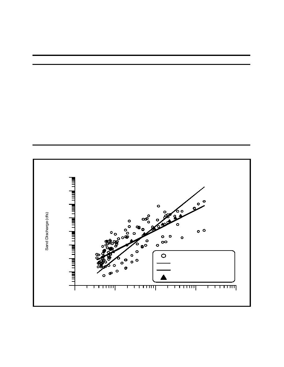
USGS Sand Fraction Data
1E-3
Yazoo Basin Study (CSU, 1978)
Regression of USGS Data
1E-4
HEC-2/Brownlie, D 50
1E-5
1E+1
1E+2
1E+3
1E+4
1E+5
Figure 5.2 Comparison of Sediment Relationships for Abiaca Creek, Site No. 6
111


 Previous Page
