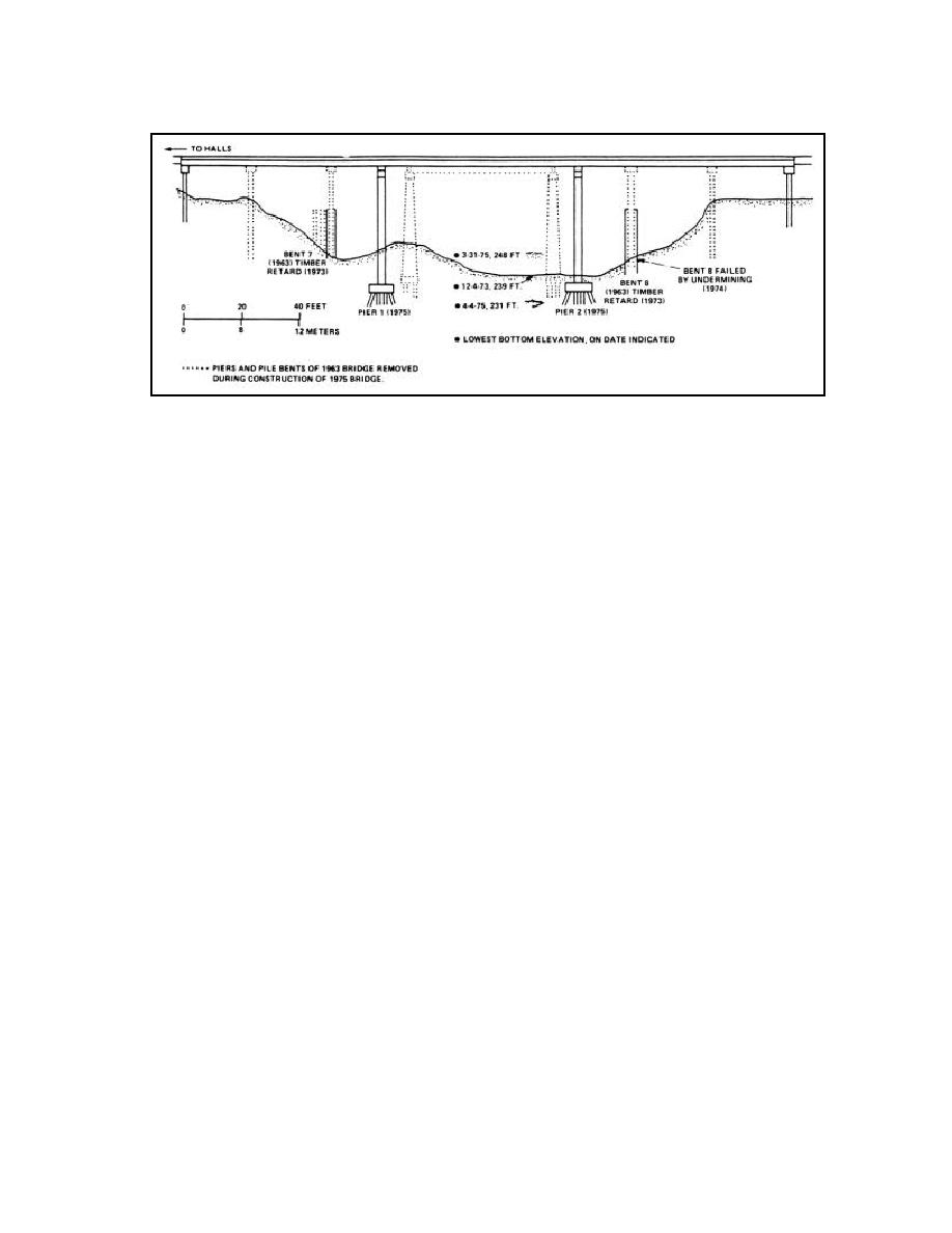
Figure 9.9c. Elevation sketch of U.S. Highway 51 Bridge (Example 8).
Between 1971 and 1973 the peak discharge was 751 m3/s (26,518 ft3/s) (17 years
recurrence interval). Bankfull stage occurred several times with high flows sustained for
periods of weeks. The left bank continued to erode behind the retard where the average
distance of recession was about 2 m (6.5 ft) for the 3-year period. Bent 7 became exposed
below the ground line. Concrete was poured at the base to prevent further erosion. Slumping
from the left bank deflected flow toward the right bank, causing rapid erosion and failure of
bent 8. The south lane of the bridge was closed. A detailed inspection was made in 1973,
but little field data was collected. Data collected indicated a large local scour problem at the
bridge. No profile data was available to evaluate the gradation problem.
In 1975 both lanes of the bridge were rebuilt, with new piers having deeper footings and less
area normal to the flow (Figure 9.9c). Single-row timber pile retards were built along both
banks in the vicinity of the bridge. A large scour hole in the center of the channel downstream
from the bridge, attributed to flow constriction during bridge construction, was filled with
gravel.
In 1977 a detailed inspection was made and cross-section data at the bridge indicated that
the local scour problem was somewhat corrected and the gradation problem was fairly
stable. Effectiveness of the timber pile retard had not yet been tested, and the area between
the retard and the bank was not accumulating sediment. The lowermost face plank on the
retard was about 1.5 m (5 ft) above the streambed. From experience face planks should be
extended to, or below, streambed elevation. In addition, the upstream end of the retard
seemed to be keyed into the bank for an insufficient distance. Vegetation was becoming
re-established on the banks, which appeared more stable in 1977 than in the recent past.
The original bridge failed in 1974 because of channel degradation and concurrent bank
recession, which are directly attributable to straightening of the channel for drainage purposes
and clearing of the banks and floodplain for agricultural purposes. Channel width increased
by a factor of approximately 2, between 1969 and 1976. The clearing of vegetation is
apparently one of the most critical factors, because channel straightening in the 1920s which
was not accompanied by extensive clearing, did not result in significant bank instability. The
timber pile retard installed in 1971 was of inadequate design, in view of the seriousness of
the problem.
9.29


 Previous Page
