

Fact Sheet
US Army Corps of Engineers
U.S. Army Engineer Research and Development Center
January 2003
Public Affairs Office
3909 Halls Ferry Road
Vicksburg, MS 39180-6199
(601) 634-2504
http://www.wes.army.mil
Periodic Inspections of Coastal Structures
Purpose: To periodically monitor selected coastal navigation structures to gain an understanding of the long-term
structural response of unique structures to their environment.
Background: Many coastal navigation structures have been intensely monitored for a finite length of time under
authority and funding of the Monitoring Completed Navigation Projects (MCNP) program of Headquarters, U.S.
Army Corps of Engineers. After the comple-
tion of the MCNP work unit, most regimented
monitoring efforts are abandoned. Continued
periodic, low-level monitoring of these struc-
tures, and others having unique design fea-
tures, on a periodic basis could add to the
Corps' understanding of the long-term re-
sponse of a particular structural design to its
environment. These periodic data sets can be
used to improve understanding in the design,
construction, and maintenance of both existing
and future structural projects, and will help
avoid repeating past designs that have failed
and/or resulted in high maintenance costs.
Relatively low-cost remote sensing tools and
techniques, with limited ground truthing sur-
veys, are the primary inspection tools used in
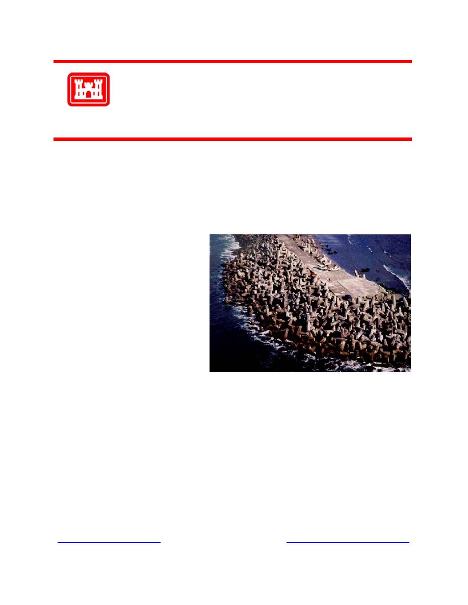
the periodic monitoring efforts. Most periodic inspections consist of capturing above-water conditions of the struc-
ture at periodic intervals using high-resolution aerial photography. Structural changes (primarily armor unit
movement) are quantified through photogrammetric techniques.
Facts: As part of the MCNP program, periodic inspections have been conducted for many coastal navigaton struc-
tures. Included are breakwaters at St. Paul Harbor, AK; Nawiliwili, Laupahoehoe, and Kahului, HI; Ofu Harbor,
American Samoa; Crescent City Harbor, CA; Burns Harbor, IN; and Cleveland Harbor, OH; and jetties at Humboldt
Bay, CA, and Manasquan Inlet, NJ. When a coastal structure is photographed at low tide, an accurate permanent
record of all visible armor units is obtained. Through the use of stereoscopic, photogrammetric instruments in con-
junction with photographs, details of structure geometry can be defined at a point in time. By direct comparison of
photographs taken at different times, as well as the photogrammetric data resolved from each set of photographs,
geometric changes (i.e., armor unit movement and/or breakage) on the structure can be defined as a function of time.
Thus, periodic inspections of the structures capture permanent data that can be compared and analyzed to determine
if structure changes are occurring that indicate possible failure modes and the need to monitor the structure(s) more
closely. Normally, base conditions are established and documented in the initial effort, and the site is reinspected
periodically to obtain long-term structural performance data.
Points of Contact: For additional information, please contact Mr. Robert Bottin at 601-634-3827
( ) or Mr. Dennis Markle at 601-634-3680 )"> ).

 Previous Page
