Modeling of Wave Climate
and Littoral Transport
Description
Wave modeling investigation was conducted to study the impact of a proposed borrow
area on the wave climate and sediment transport potential at Virginia Beach, VA.
The U.S. Army Corps of Engineers District, Norfolk (CENAO), is preparing an
Issue
Environmental Assessment for the use of sand sources off the coast of Cape Henry for
future maintenance of the
Virginia Beach, VA, shoreline.
The primary purpose of the
project is to maintain a buffer
for hurricane protection for
structures landward of the
existing beach. The Cape Henry
Borrow Area is located adjacent
to Virginia Beach, and the
Atlantic Ocean Navigation
Channel. The borrow scenario
involved removing
approximately 26.1 Mm3 of
material from the borrow area
over a period of 50 years. Plan
borrow activities will deepen
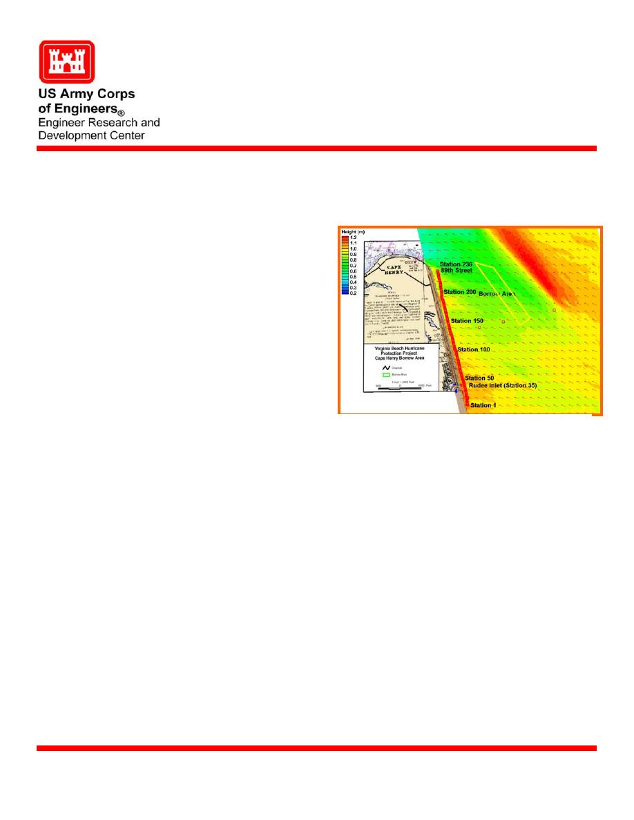
STWAVE numerical model wave transformation
the existing bottom in the
information for Virginia Beach, VA
seaward portion of the Cape
Henry Borrow Area by 4.3 m over an area of approximately 6.1 sq km.
Offshore wind-wave and swell climate was represented by Wave Information Studies
Products
(WIS) hindcast information covering the 10-yr time period 1990-99. Wave transformation
from deep to intermediate water depths was performed with the finite difference STWAVE
(Spectral Wave) model. A total of 495 wave conditions (5 heights 9 periods 11 direc-
tions) were modeled as directional wave spectra at the offshore boundary.
STWAVE numerical model provides wave transformation information over complex
Supporting Technology
bathymetry, wave-current interaction, local wave growth, and depth- and steepness-
induced wave breaking.
The study objective was to provide wave climate and potential longshore transport
Benefits
information and analysis for two bathymetric cases: existing bathymetry and Plan 1 that
included planned excavation from the Cape Henry Borrow Area. These two cases
bracketed the range of expected conditions over the next 50 years and enable assessment
of potential project impacts on littoral transport patterns along adjacent beaches.
U.S. Army Corps of Engineers District, Norfolk (CENAO).
Sponsors
Point of Contact
Dr. Michael J. Briggs, CEERD-HN-HH, 3909 Halls Ferry Road, Vicksburg, MS 39180-
6199; e-mail: , or Mr. Bruce Ebersole, e-mail:
. Additional information can be found at
U.S. Army Engineer Research and Development Center
August 2004
Coastal and Hydraulics Laboratory (Project/Mission Support)
www.erdc.usace.army.mil


 Previous Page
