ERDC/CHL CHETN-IX-14
March 2004
1.5
Customs House
1.0
0.5
0.0
-0.5
-1.0
RMA10-2D
Prototype
-1.5
0
24
48
72
96
120
144
168
192
Time, hrs (from midnight 04/19/99)
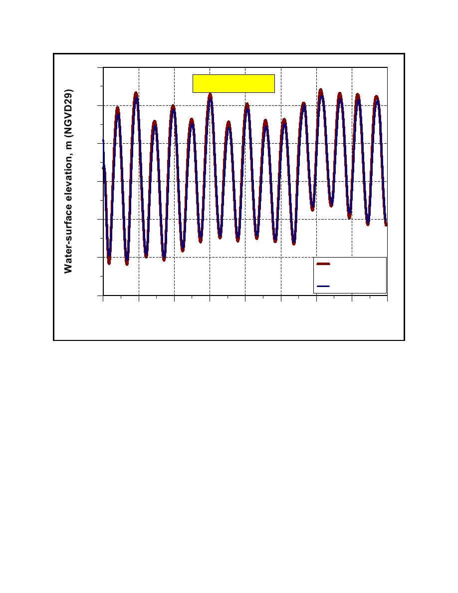
Figure 4. Comparison of measured water level with RMA10-2D predictions at Custom House location
The current velocity components from RMA10-2D were reduced to a magnitude and azimuth
measured clockwise from north. For determination of the ship's speed relative to the water, the
magnitude of the current velocity was assumed to be inward, outward, or normal to the ship's track
based on the azimuth. The ship's speed relative to the water was determined by adjusting the ship's
ground speed by adding or subtracting (depending on the direction of ship's travel) the magnitude of
the inward or outward current velocity. The magnitude of the current was used to compute the ship's
speed relative to the water instead of computing the actual velocity component along the ship's
track. This was justified since the magnitude of the current velocities was relatively small (maximum
of about 0.9 m/sec (3 ft/sec)) compared to the ship's speed and the difference between the magnitude
and its x- and y-components was normally small. For current velocities normal to the ship track, the
ship's ground speed was used with no adjustments.
The speed of each ship was computed for each time-step (1 or 3 sec) and plotted relative to Eastern
Standard Time (EST). These calculations were performed for the bow, port, and starboard GPS
receivers and are shown in Figure 5 for the two example vessels. These plots were examined and
points of evaluation were determined based on relatively constant ship speed and the stability of the
10


 Previous Page
