

Table 1 1
Port Mansfield Jetties
Port Mansfield, Texas
Date(
Construction and Rehabilitation History
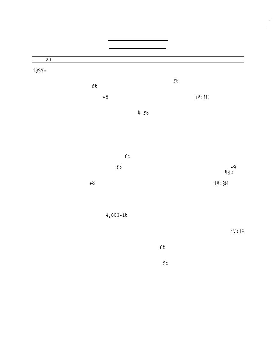
Local interests dredged a channel across Padre Island and constructed
1961
two tetrapod jetties at the entrance to the Gulf of Mexico. The
north and south jetties were 1,600 and 8 0
0
long, respectively, and
spaced 1,000
1 tons each and were placed directly on the existing bottom to a
6
ft mlt, a 10-ft top width, and
cross section of
side slopes
(Figure 13, inset). Within a year these jetties were no longer pro-
viding adequate channel protection. The tetrapods had subsided, the
shore ends were in water 2 to
deep, scour channels existed along
sections of both jetties, and extensive shoaling had occurred in the
entrance channel. By 1961 the inlet had closed and the tetrapods
were nearly submerged.
1962
Two rubble-mound jetties were constructed under Corps management and
Federal funding as part of navigational improvements between Port
jetties (2,300 and 2,270
long, respectively) were constructed on
the south sides of the existing tetrapod jetties. The parallel
jetties, spaced 1,000 apart, terminated at approximately the
ft
mlt contour. The jetties were staggered with the south jetty
ft
east of the north jetty. The design geometry (Figure 13, inset) con-
ft crown elevation, 16-ft crown width, and
sisted of a
side
slopes. The cross section was built on a 3-ft-thick bedding layer of
0.5-in. to 200-lb stone. The bedding layer was to extend beyond the
ends of the cover stone layer, typically 2 ft at the landward ends to
15 ft at the seaward ends. The core was built up using 200- to
1,000-lb stone along landward sections (each several hundred feet
long) and 200- to
stone along the remaining seaward sec-
tions. Jetty permeability was decreased by supplementing a mid-
this combined core stone extended below the full crown width at
side slopes. The cubically shaped granite cover stone increased in
size from 1 to 1 tons, between landward and seaward ends of each
0
of each jetty had an addi-
jetty, respectively. The seaward 1 0
0
tional layer of 6- to 10-ton cover stone placed on the side slopes.
Stone sizes were selected using Hudson's slope stability formula and
at the seaward ends (+6 ft
depth-limited wave heights of up to 12
mlt surge level). The foundation for the jetties consisted of var-
ious sand and clay layers, including a 1 - to 15-ft-thick layer of
0
soft clay. Soil tests indicated that the clay layer could consoli-
date up to 0.75 ft (seaward end), and total structure settlement on
jetty materials). Total cost was ,736,000with 307,030 tons of
stone placed and 10,000 tons of blanket stone stockpiled.
(Continued)
44

 Previous Page
