

Fact Sheet
US Army Corps of Engineers
U.S. Army Engineer Research and Development Center
January 2003
Public Affairs Office
3909 Halls Ferry Road
Vicksburg, MS 39180-6199
(601) 634-2504
http://www.wes.army.mil
Design for Enhancement of Wave-Induced Circulation at Kaunakakai
Harbor, Molokai, Hawaii
Purpose: To study wave conditions, wave-induced current patterns and magnitudes, and sediment movement pat-
terns at the existing site and develop alternative plans that will alleviate poor water circulation and sediment buildup
in the area.
Background: Kaunakakai is located on the south-central coast of the Island of Molokai,, Hawaii. The harbor is
located adjacent to Pier Island at the end of a causeway that extends seaward about 1,900 ft from shore. It con-
sists of a deep draft port adjacent to the
west side of the island and a small-craft
harbor, protected by breakwaters, on the
east side of the island. The area immedi-
ately east of the causeway was a mud
flat. Poor water circulation had resulted
in the collection of a large amount of
sediment and debris.
The original
causeway was built on piles, which al-
lowed currents and sediments to flow
through the structure. In later years, it
was reconstructed using fill materials.
Subsequent modifications included ex-
tending the facilities seaward, filling the
area, and building new facilities on the
fill. These actions inhibited the flow of
currents and sediments around and
through the structure.
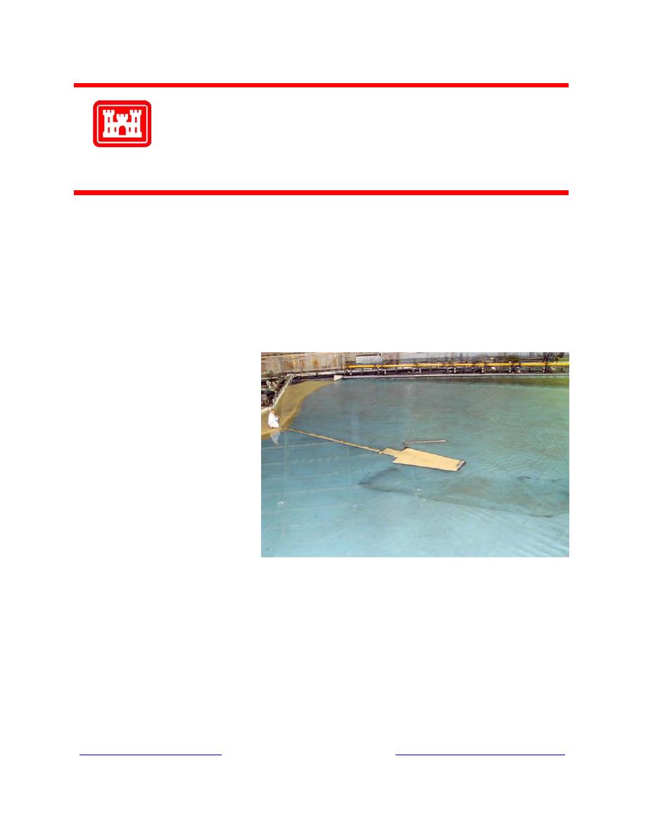
Facts: At the request of the U.S. Army Engineer District, Honolulu, a 1:75-scale physical hydraulic model was de-
signed and constructed at the U.S. Army Engineer Research and Development Center by the Coastal and Hydraulics
Laboratory to study wave, current, and sedimentation conditions at the harbor and develop alternative plans to en-
hance circulation and alleviate sedimentation. The model reproduced approximately 6,600 ft of the Molokai shore-
line, the existing causeway and harbors, and bathymetry in the Pacific Ocean to an offshore depth of 60 ft. Included
was the relatively flat, shallow reef that extended seaward about 3,200 ft. A 70-ft-long unidirectional, spectral wave
generator, an automated data acquisition and control system, capacitance-type wave gauges, and coal tracer materi-
als were used in model operation. Experimental results for a series of 20-ft-wide culverts in the causeway revealed
that currents would jet through the culverts with relatively high velocities, meander in eddies, and dissipate or only
slowly migrate to the west. It was determined that a 600-ft opening extending seaward from the shoreline (repre-
senting a pile-supported causeway, or a bridge) would result in continuous current and sediment flow downcoast in a
westerly direction.
Points of Contact: For additional information, please contact Mr. Robert Bottin at 601-634-3827
( ) or Mr. Dennis Markle at 601-634-3680 )"> ).

 Previous Page
