Fact Sheet
US Army Corps of Engineers
U.S. Army Engineer Research and Development Center
February 2003
Public Affairs Office
3909 Halls Ferry Road Vicksburg, MS 39180-6199 (601) 634-2504
CHL web site chl.erdc.usace.army.mil
Flow Table Model of Cook Inlet, Alaska
Purpose: To describe and summarize a small-scale physical model study of tidal flow in upper Cook Inlet, Alaska.
The study was conducted using the Coastal and Hydraulics Laboratory (CHL) Precision Flow Table.
Background: Shoaling at Anchorage Harbor during the summer
months has required annual dredging that averages between 200,000
and 400,000 yd3 per year with occasional larger deposition quantities
between 800,000 and 1,000,000 yd3. The tidal flow regime is
characterized by a large tidal range and significant flow separation
and turbulence at major headlands. The U.S. Army Engineer
District, Alaska, sponsored flow table studies to determine if the
turbulent flow regime could be correctly modeled using a large,
distorted-scale physical model of Cook Inlet. The study also
provided initial screening of the hydrodynamic flow regime in upper
Cook Inlet in the vicinity of the Port of Anchorage.
Facts: Two types of flow table models were designed and
constructed for this study: (a) Idealized models at two different
scales with bathymetry represented as two or three horizontal
terraces, and (b) a 3D model that reproduced actual bathymetry
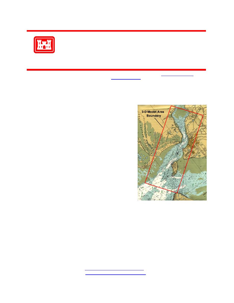
covering Cook Inlet over the 31-mile reach outlined on the
photograph. The model had a horizontal length scale of 1:15,000 and
a vertical length scale of 1:100 giving a model distortion of 15. The
3D model was divided into six sections over the 31-mile reach, but
only four sections (about 20 miles) could be placed on the flow table
at a time. By removing sections on one end and adding sections on the opposite end, different reaches of Cook Inlet
to be tested with adequate upstream boundaries represented in the model.
Flow patterns were visualized and observed in both the idealized and 3D models for maximum flood and ebb flow.
The flow table models helped to clarify the flow regime, which included flow separation and large vortex regions in
the lee of the major headlands; and flow visualization techniques indicated that shoaling at the Port of Anchorage
was enhanced by ebb tide flow separation occurring at a headland (Cairn Point) located just upstream of the Port.
This particular finding had not been hypothesized prior to the flow table tests. Evidence of three-dimensional flow
circulation patterns factored into the District's evaluation of more comprehensive modeling approaches. Injected dye
was used to investigate how dredged sediment might move when deposited from barges at different locations during
both ebb and flood flows. Depending on the flow direction and the injection point, it was not unusual to observe dye
migrating back into the vicinity of the Port. These simple experiments revealed more efficient dredging and
disposal practices that could substantially reduce the amount of deposited dredge material re-entering the Port area.
Points of Contact: For additional information, please contact
Dr. Steven Hughes at 601-634-2026 ( ), or
Mr. Dennis Markle at 601-634-3460 ( )"> ).


 Previous Page
