

National Erosion Control Development and Demonstration
Program (Section 227)
Jefferson County, Texas
Description
The Jefferson County, Texas, project location fronts the McFaddin National Wildlife
Refuge near High Island, 49 km (30.4 miles) west of the Texas/Louisiana border. Beaches
at the demonstration area consist of a thin sand veneer over mud. Wave heights average
between 0.76 m (2.5 ft) and 1.4 m (4.6 ft), with much higher waves occurring during
storms. Mean tide range is 3 m (1.28 ft). The annual average long-term shoreline erosion
rate is approximately 3 m (10 ft). Since 1980, most of the roadway spanning the coast
between High Island and Sabine Pass has been closed due to coastal erosion.
Issue
Storms erode the thin layer of
sand, exposing the mud to
further erosion. During
storms, beach sediment that is
not pulled offshore may be
washed over the low-lying
dune and deposited in a wet-
land area landward of the
beach. Overwashed sediment
is not recovered from the
wetland and returned to the
beach profile, which has
limited post-storm recovery
due to a deficit of sediment in
the littoral system.
Technology
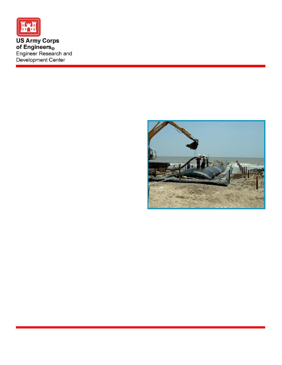
The primary objectives of the Geotube is constructed along beach
project will be to minimize
erosion of the exposed cohesive sediment and to minimize sand overwash. These objec-
tives will be accomplished by constructing experimental low-volume beach nourishment
templates contained by geotextile tube groin cells and dune construction. The 762-m-
(2,500-ft-) long dune is designed to withstand a 5-year return period storm. Fronting half
of the engineered dune corridor is beach nourishment divided into four experimental cells
of varying fill volume and grain size. The objective of the nourishment is to investigate the
longevity of minimal fill volumes (15 to 30 m3/m or 6 to 12 yd3/ft) combined with native
beach sand (0.17 mm < d50 < 0.21 mm) or sand larger than what is naturally present on the
active beach profile (0.31 mm < d50 < 0.40 mm). A geotextile tube groin separates each
experimental cell. The function of the tube is to only contain the experimental areas.
Status
The Final Environmental Assessment was approved and the Findings-of-No-Significant-
Impact (FONSI) was signed in the fall of 2003. The Memorandum of Agreement with the
Texas General Land Office was also signed and construction was completed in August
2004. A 36-month project-monitoring program was established with the first monitoring
surveys completed in August 2004. A post-storm (Hurricane Ivan) survey was completed
in September 2004, and a quarterly survey was performed in December. The monitoring
May 2005
U.S. Army Engineer Research and Development Center
www.erdc.usace.army.mil

 Previous Page
