National Erosion Control Development and Demonstration
Program (Section 227)
Chesapeake Bay Breakwaters
Description
This project has identified 41 nearshore segmented breakwater study sites, located along
the Maryland and Virginia shorelines of the Chesapeake Bay. The long-term goal of this
demonstration project is to document breakwater system performance around the
Chesapeake Bay, develop an index/database of existing site data, monitor select sites, and
using this data, develop
design guidelines for future
use of nearshore, segmented
breakwaters in cohesive,
sand-limited, and fetch-
limited systems (i.e., estu-
aries, reservoirs, lakes, and
bays).
Issue
The use of breakwaters for
shore protection in the
Chesapeake Bay has
increased over the past
15 years. The primary goal of
these breakwater systems is
long-term erosion control. As
these sites age and go through
more storms, they appear to
become more resilient.
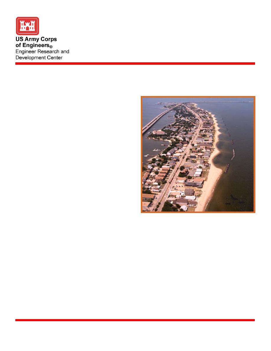
Pocket beaches form and
provide shore protection
during storm events. Often,
beach fills, wetland planting, Willoughby Spit, southern shore of Chesapeake Bay,
and habitat enhancement
Norfolk, Virginia
accompany and enhance these
breakwater system projects. As a method of evaluating these systems, the beach morph-
ology and how it evolved is a prime research interest. Yet, many of the sites have received
little or no monitoring, assessment or evaluation. Although design guidance has been
developed for open coast breakwater application, its applicability to the short-fetched,
shallow-water environments of the Chesapeake Bay and similar estuaries has not been
established.
Status
This project has completed the monitoring stage and an ACCESS database has been
developed. The final year of monitoring data is being evaluated and entered in to the
database. One additional year is planned for data analysis and the development of design
guidance. Out years may include workshops and database sharing. The database has been
created for 41 breakwater sites in the Chesapeake Bay. Post-construction data collected for
the breakwater and surrounding area include elevations surveys, vegetation surveys, hydro-
dynamic analysis, and photographs. In Fiscal Year 2003, six sites around the bay were
chosen for detailed analysis. These surveys were conducted during the months of August
U.S. Army Engineer Research and Development Center
May 2005
www.erdc.usace.army.mil


 Previous Page
