

Project: Chief Joseph 1:80-scale General Model
PI: Glenn Davis
Branch/Group: Inland Hydraulic Structures Branch, Structures and Channels Group
Project Description/Activities/Capabilities:
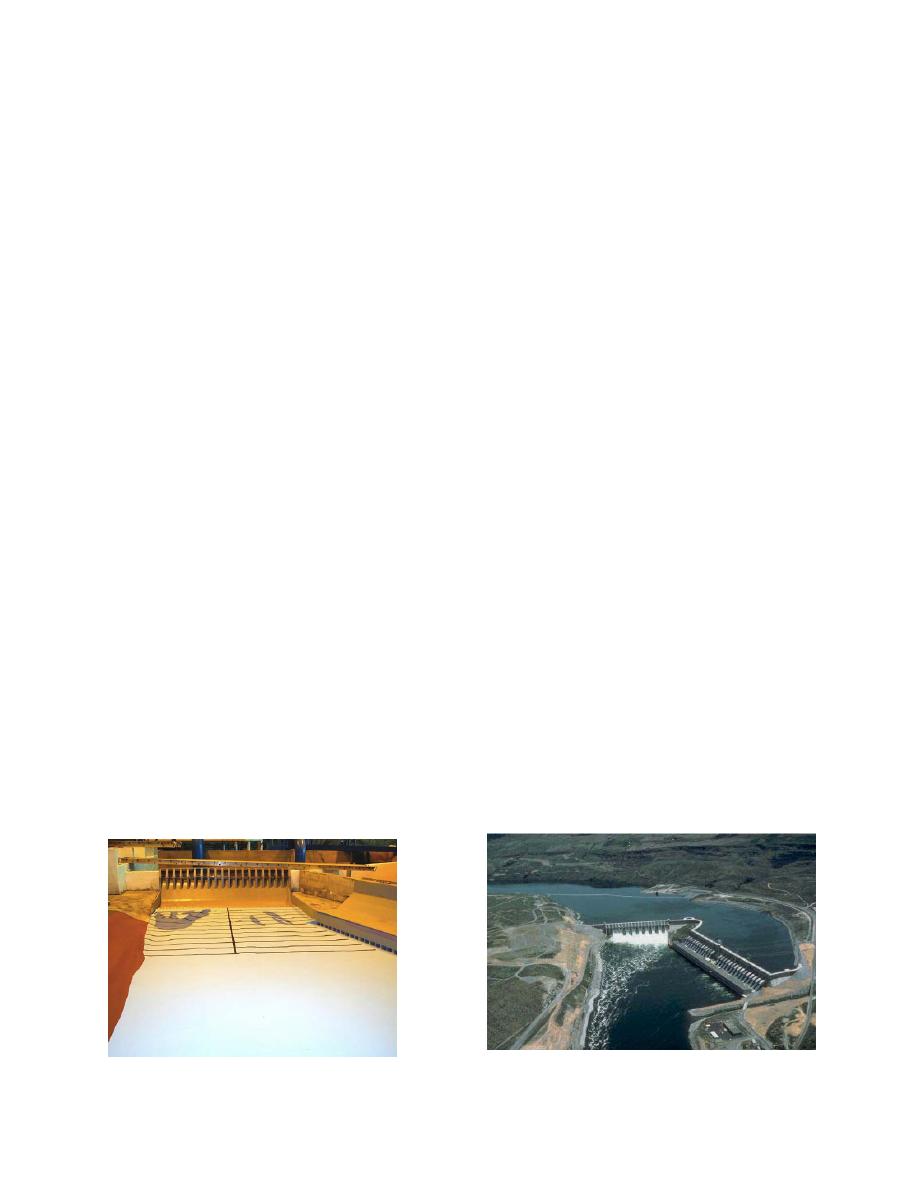
The Chief Joseph 1:80-scale physical model used for evaluating spillway flow deflector impacts on
hydraulic conditions in and downstream of the spillway stilling basin
Sponsor: Seattle District, POC Marian Valentine and Mike Deering
CHL Personnel Glenn Davis, Jose Sanchez, Steve Wilhelms, Bobby Joe Fuller, Doug White
Project Location and Description:
Chief Joseph Dam (CJD) stretches over one mile across the rolling Columbia River at river mile 545.1.
Behind the dam, lies Rufus Woods Lake, which extends 51 miles upstream to Grand Coulee Dam. CJD
discharges into Lake Pateros, which extends 29.5 miles to Wells Dam. CJD is the Corps' largest power-
producing dam. The powerhouse consists of 27 main generators with a hydraulic capacity of 219 kcfs
and a nameplate capacity of 2069 MW. The Chief Joseph powerhouse is oriented in an east-west
direction about 90 degrees to the spillway. The spillway at CJD has a total length of 980 ft and consists
of 19 radial gate-controlled bays. The width of each bay is 49 ft as measured from the centerline of the
pie rs, and the radial gates have a width of 36 ft. Piers, 13 ft in maximum width, separate the bays. The
spillbays are numbered from 1 to 19 from north to south. The elevation of the spillway crest is 901.50 ft.
The operating pool for Rufus Woods Lake ranges from elevation 950 to 956 ft. The tailwater elevation
typically ranges between elevations of 780 to 790 ft depending upon the total river flow and Lake Pateros
pool elevation. The stilling basin at CJD has a length of 167 ft and a stepped end sill with a height of 11
ft. Energy dissipation is provided by a series of baffle blocks located near the end of the stilling basin with
a height of 11 ft. The invert elevation of the stilling basin apron is at 743 ft resulting in a typical depth of
flow about 36-42 ft. An end wall extending the length of the stilling basin bounds the north side of the
spillway adjacent to bay 1. The tailwater channel bed elevation varies in elevation downstream of the end
sill ranging in elevation from 740 downstream of bays 6 and 7 to elevation of 755 ft downstream of bays 9
through 19. The channel bed elevation gradually rises in elevation downstream of the spillway to an
elevation of about 755 ft downstream of the powerhouse.
Facilities: Bldg. 3051
Related Topic Areas: Physical models, salmon migration, fish passage, flow deflectors, surface water,
reservoirs, rivers, hydraulic structures, hydropower

 Previous Page
