

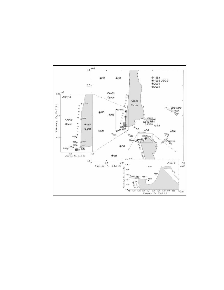
Station OS 6 was located approximately 1,040 m (3,412 ft) offshore of the mhhw
line at a bottom elevation of -9.1 m (-30 ft) mllw. In 2002, sta OS 7, OS 8 and
OS 9 were deployed parallel to shore, north of sta OS 5 and approximately 305 m
(1,000 ft) offshore of the mhhw line and at approximately -3.6 m (-11 ft) mllw.
Stations DP 1 and DP 2 were deployed inside the entrance to Grays Harbor along
the western shore of Damon Point, at approximately -2.1 m (-7 ft) mllw.
Figure D1. Instrument deployment locations
In 2001, several ADP transects together with grab samples of SSC and
bottom sediment were obtained near the north jetty; ADP transects were also
obtained from the outer and inner inlet in September 2001. Concurrent with the
spring 2001 deployment, the USGS deployed six tripod systems on the Grays
Harbor ebb shoal to the north and south of the inlet (sta ND, NS, MD, MS, SD,
SS; Figure D1).
PI Engineering processed the data with SonTek and in-house software.
Initial quality checks of the data from the first deployment of SIDSEP
(6-9 February 2001) indicated that a portion of the velocity data from the Hydra's
ADV Ocean current meters was compromised by velocity ambiguities. The most
likely cause of these errors appeared to be a low velocity range setting of
D3
Appendix D
Field Data Collection

 Previous Page
