

ERDC/CHL CHETN-I-67
June 2003
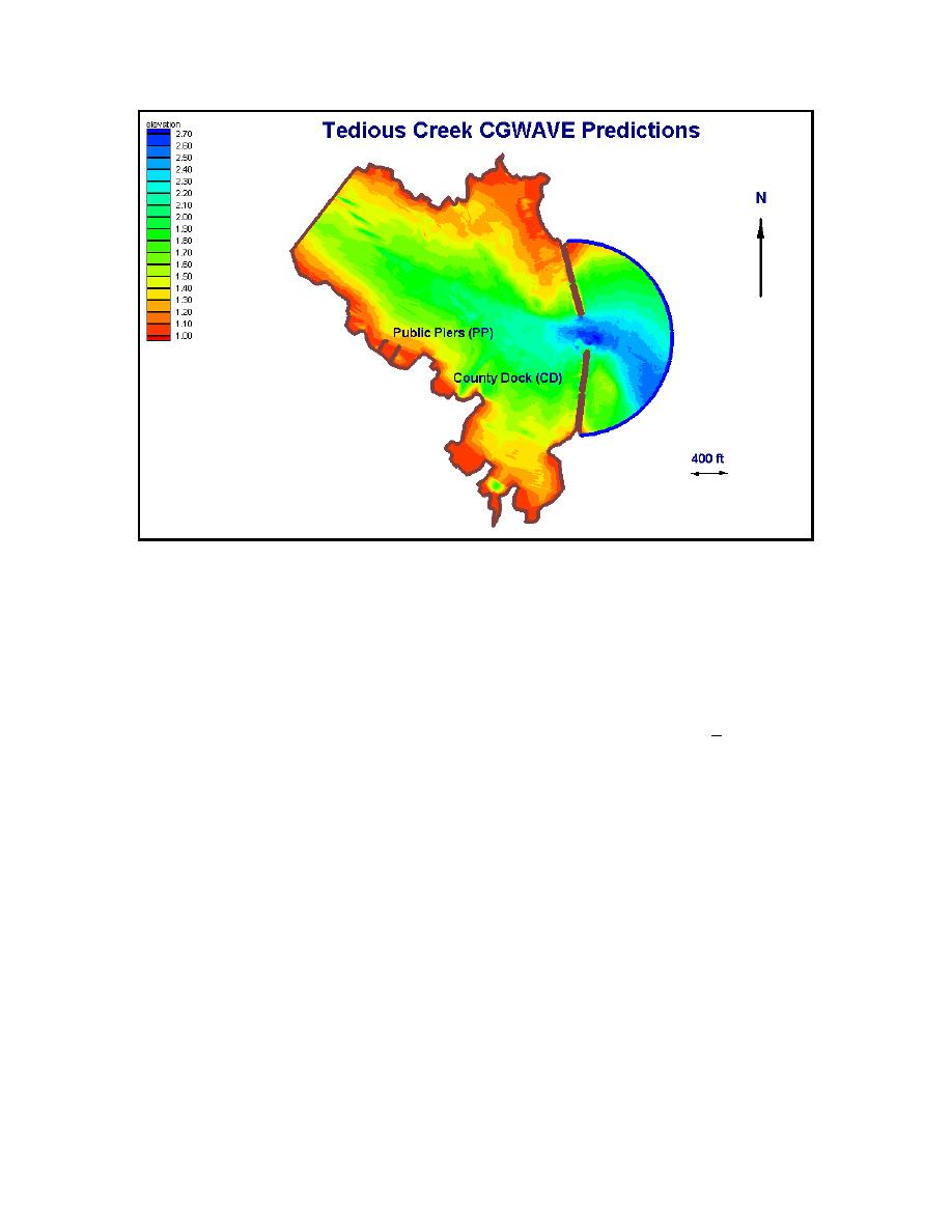
Figure 3. Tedious Creek bathymetry with water level of 1.0 m mllw for existing configuration
Nine different wave conditions, composed of three wave periods and three wave directions, were
selected for study based on harbor orientation, limited field measurements, local observations, and
previous analysis (OCTI 2001). Wave periods T = 6, 10, and 16 sec were selected as representative
of the range of wave periods occurring in the harbor. The OCTI study (2001) used a JONSWAP
spectrum with a peak period in the range of 8 to 10 sec. The T = 6 sec was chosen as the minimum
period for use of CGWAVE. The T = 16 sec value was selected as the worst-case swell waves that
might propagate into the harbor from Atlantic storms. Mean wave directions of θ = 135, 180, and
225 deg represent waves propagating to the northwest, west, and southwest (angles measured
counterclockwise from the east), respectively. The OCTI study (2001) used these direction limits,
with waves from the southwest considered the worst case for the CD even though they also tested
waves from 210 deg (west-southwest). Waves traveling to the west and southwest are most likely to
affect the PP and CD, respectively, since they have a clear path through the breakwater gap.
According to the Section 107 Feasibility Report (1995), 5-year storm significant wave heights
traveling to the southwest to northwest range from Hm0 = 0.5 m (1.6 ft) to 0.7 m (2.3 ft). Fifty-year
storm heights varied from Hm0 = 0.6 m (2.1 ft) to 1.5 m (4.9 ft). A representative value of 1 m was
selected as the incident wave height HI at the offshore grid boundary. All modeled waves were
regular (i.e., monochromatic).
0.1, 0.5, and 0.9 were selected for the open ocean, inner bay perimeter, rubble-mound breakwater,
and PP, respectively. As mentioned previously, the CGWAVE model requires small element sizes
in shallow-water regions for accurate description of short-period waves.
4

 Previous Page
