

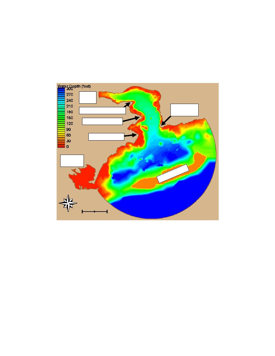
for the numerical model was obtained by using HED data and supplementing
with NOS chart data in areas seaward of HED coverage.
The numerical model seaward boundary is a semicircle. For this study, the
model boundary was extended seaward far enough to encompass relevant
shallow areas outside the entrance to Pago Pago Harbor embayment (Figure 10).
The model domain includes Taema Bank and extends beyond to deep water.
PAGO
PAGO
BREAKERS
GOAT ISLAND POINT
POINT
TULUTULU POINT
NIULOA POINT
PALA
LAGOON
NK
BA
MA
AE
T
N
Miles
0
1
Figure 10. Model bathymetry, existing harbor (To convert to SI, multiply feet by
0.3048 for meters; multiply miles by 1.609347 for kilometers)
A finite element grid was constructed over the model domain (Figure 11).
Grid element size is based on the needed model resolution for the shortest period
waves in the shallowest water depth of concern in the study. For the longer
period waves, the grid gives a high degree of resolution. Grid characteristics are
summarized in Table 2. Bathymetric data discussed above were transferred onto
the finite element grid. The SMS software was used for all bathymetry and grid
development.
wave and swell tests, Kr values were estimated as zero in consideration of the
pervasive coral reefs fringing the shoreline. Bottom friction was set to zero.
Additional parameter values used in the numerical model are summarized in
Table 3.
16
Chapter 3 Numerical Model

 Previous Page
