Fact Sheet
US Army Corps of Engineers
U.S. Army Engineer Research and Development Center
January 2003
Public Affairs Office
3909 Halls Ferry Road
Vicksburg, MS 39180-6199
(601) 634-2504
http://www.wes.army.mil
Sedimentation and Hydrodynamic Study of U.S. Coast Guard Station Boat
Basin, Port Huron, Michigan
Purpose: To qualitatively study sediment movement pathways and deposition at the harbor entrance and quantify
wave conditions inside the boat basin and to develop remedial plans to alleviate undesirable wave and shoaling con-
ditons at the entrance to and inside the harbor.
Background: The U.S. Coast Guard Station, Port Huron, includes a small boat basin at the extreme southern port-
ion of Lake Huron where the lake empties into
the St. Clair River. This location is ideal for res-
cue operations for heavy summer recreational
boat traffic on lower Lake Huron and the upper
St. Clair River. However, because the basin is
located in the dynamic lake-to-river transition
region, sedimentation at the harbor entrance is so
severe that rescue operations are limited and
frequent dredging is required. In addition, verti-
cal sheet pile walls contribute to undesirable
reflective wave energy inside the basin from
wind waves and vessel-generated waves from
ship traffic. Strong currents in combination with
waves also cause problems for navigating into
the basin. At times shoaling is so severe the res-
cue operation has to be moved to a marina lo
cated on the St Clair River. This results in extended response times and other safety issues that are not desirable to
the Coast Guard.
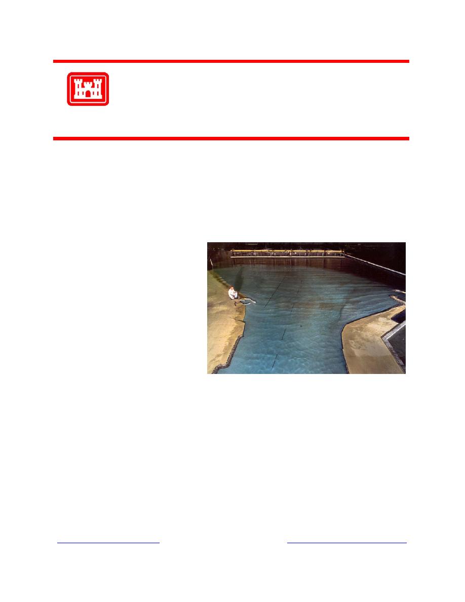
Facts: At the request of the U.S. Army Engineer District, Detroit, and the U.S. Coast Guard Civil Engineering Unit,
Cleveland, a 1:60-scale physical hydraulic model was designed and constructed at the U.S. Army Engineer Research
and Development Center's Coastal and Hydraulics Laboratory to study shoaling, current, and wave conditions at the
site. The model reproduced the extreme southern portion of Lake Huron and the entrance to the St. Clair River.
About 0.7 miles of the United States shoreline was reproduced on the west, which included Port Huron Harbor, as
well as 0.8 miles of the Canadian shoreline on the east. A 60-ft-long unidirectional, spectral wave generator, an
automated data acquisition and control system, capacitance-type wave gauges, a model circulation system, remote-
controlled navigation vessels, and coal tracer materials were used in model operation. Multiple modifications were
made to the basin configuration to determine an optimum alternative for alleviation of undesirable conditions. The
existing north breakwater was reoriented and terminated 40 ft lakeward of its original termination point and, in addi-
tion, a 40-ft-long lakeward extension of the structure was included. The final plan minimized shoaling at the harbor
entrance, reduced wave heights in the basin for both wind waves and vessel-generated wakes, improved navigation
conditions, and should not cause any adverse impacts downstream of the harbor in the river.
Points of Contact: For additional information, please contact Mr. Robert Bottin at 601-634-3827
( ) or Mr. Dennis Markle at 601-634-3460 ( )"> ).


 Previous Page
