Home
Download PDF
Order CD-ROM
Order in Print
Home
>
Coastal and Hydraulics Laboratory Fact Sheets
>
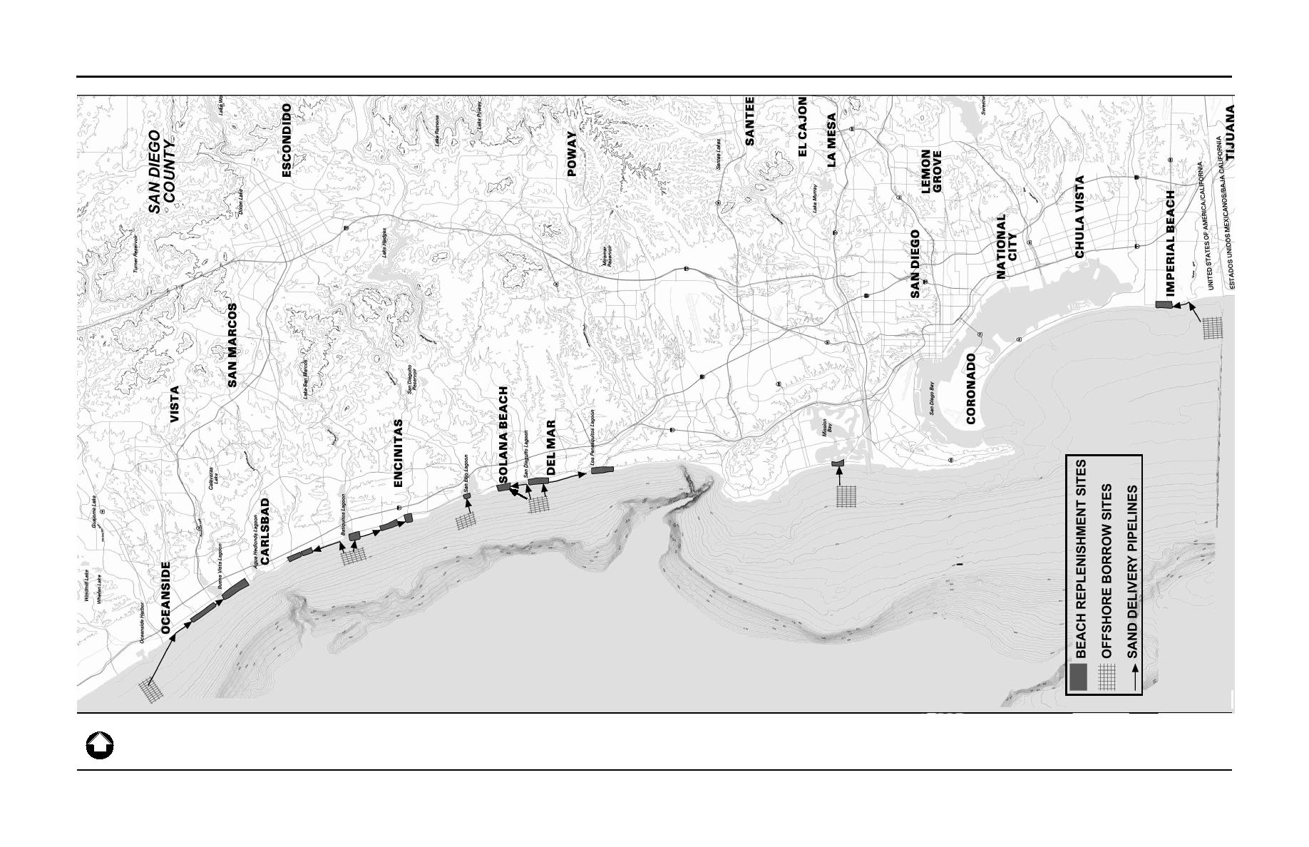
> Figure ES-1. Regional Location Map
Table ES-1. Comparison of Sand Replenishment for Navy Homeporting Project and San Diego Regional Beach Sand Project
ES-2 PURPOSE AND NEED
publicationid_592_1356
Page Navigation
10
11
12
13
14
15
16
17
18
19
20
4.0
Environmental
Consequences
Source:
SANDAG
Figure
ES-1
Regional
Location
Map
NORTH
Regional
Beach
Sand
Project
EIR/EA
Page
ES-3
9969
SANDAG
Beach
Replenishment/Figures/Fig
ES-1
Reg
Loc
map
9/15/99


 Previous Page
